Day 14 Stats:
Miles: 8.3
Starting elevation: 16,252 @ High Base Camp
Ending elevation: 12,400 @ Muktinath
**These numbers include going to The Pass at 17,700 and back down to Muktinath
Total hiking ascent: 1,704
Total hiking descent: 5,560
Dal Bhat meals: 0. We stayed at the Bob Marley hotel in town and they had pretty good continental food so we passed on the Dal Bhat for 2 days. Yak steak, yak schnitzel, carbonara and shockingly well done gnocchi with pesto and yak cheese filled our tummies after crossing The Pass.
Cost for teahouse for 2 nights (board, dinner and breakfast x 2): 4,850Nrs ~$44. The Bob Marley was more expensive than most places we have stayed, but the food was good, the shower was hot, it had a sink for washing clothes, western toilet and WIFI! Plus, anyone who knows us well can rest assured that we spent more than what is noted on celebratory drinks 🙂
 Lacy: Today was the day! Over the past 2 weeks we climbed approximately 15,000 ft as we wound up and down the Marsyangdi River. We began hiking through lush rice paddies and waterfalls, surpassed the tree line and finally crossed the Thorung La Pass in snow this morning. All the time we spent slowly ascending and making sure we properly acclimatized our bodies paid off in dividends. Rob and I were so strong the past 3 days as we continued to climb towards our goal of 17,700ft and this morning was no exception. It was chilly when we woke up even with the extra blanket we requested at the teahouse. After fueling our bodies with more pancakes we began our hike in hats and gloves we had purchased weeks earlier in Kathmandu. The closer we got to the pass the cooler it became until snow flurries began to surround us! It was so beautiful to be hiking in the snow dusted mountains and looking up at the even whiter peaks.
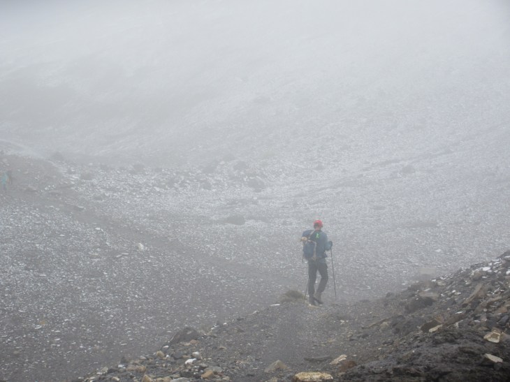
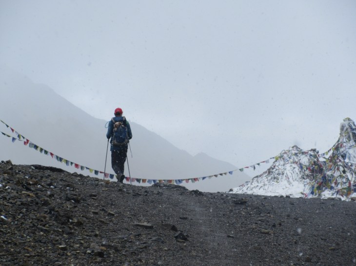
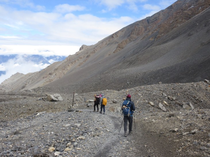
We hike into the snow for the final climb

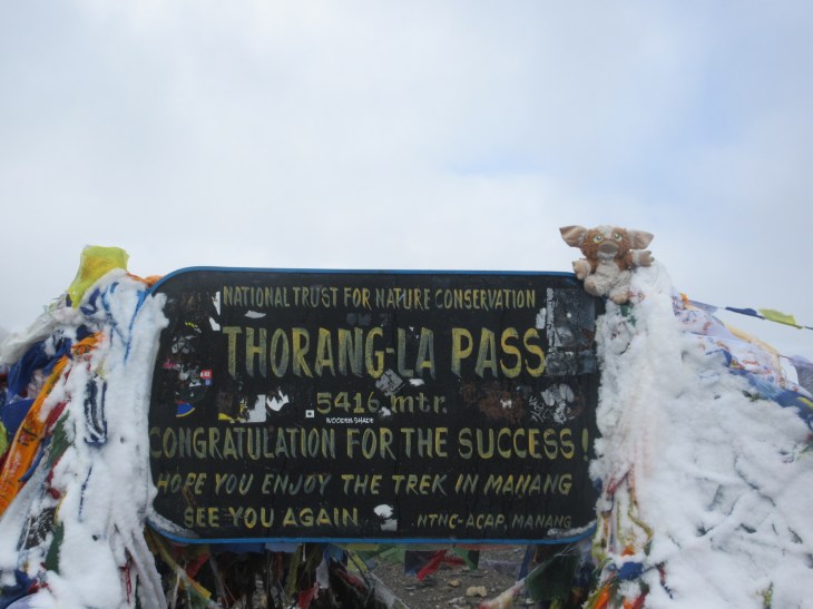
Prayer flags alert us to the summit…
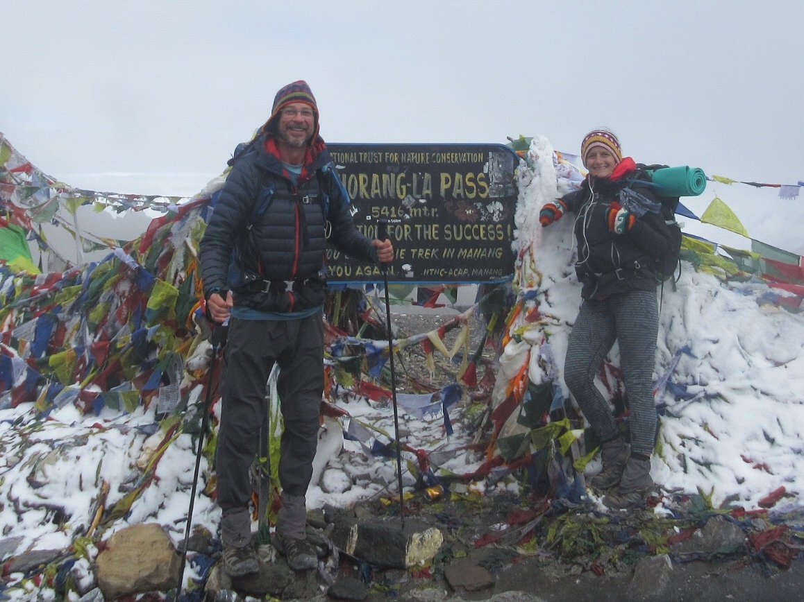
Rob and Giz make it!
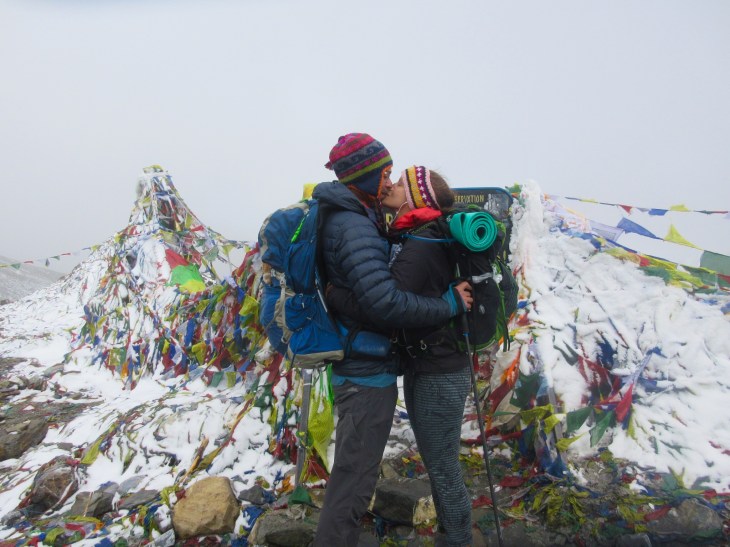
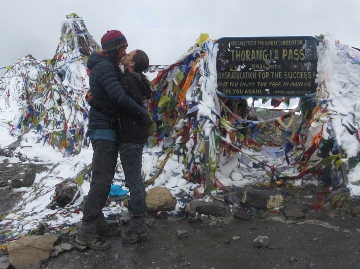
We pushed forward and as we approached the summit the prayer flags alerted us to our victory. We made it! I instantly hollered and jumped from the excitement of having accomplished this feat together. We were both oozing adrenaline and glee. It just so happened, completely by chance, that we climbed the pass on an exceptionally clear day. We were rewarded with views from The Pass that have been hidden in clouds most other days recently. Visible to us were the snow covered Himalayas. Below, the view of the valley that we would now descend more than 5,000 ft into before reaching lunch! Huge smiles were plastered onto our faces all day long. It took 90 minutes to reach Thorung La Pass from High Base Camp and another 3 1/2 to descend towards a comfortable place to rest our feet and cheers over a cool beer. It feels so good to use your body like a tool while hiking and accomplish goals with your partner. Definitely one of our best days!
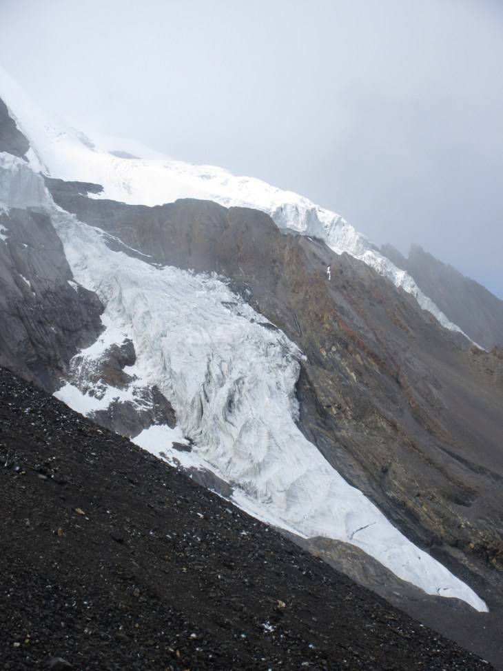
Great snowy views at The Pass
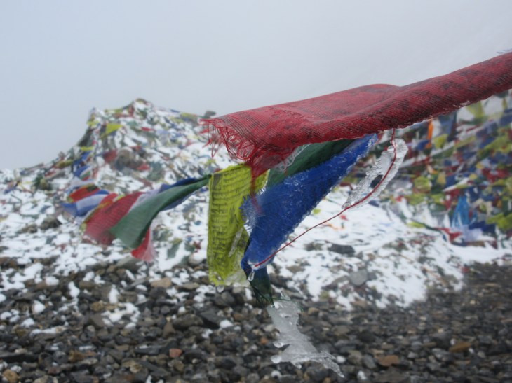
Icicles hanging from the prayer flags

Rob: We left High Base Camp at 7:15am which meant that we were the last to leave for the Pass. The climb was tough and into the misty clouds so each time you saw what might be a high point of the trail, it was really just a junction to another stretch up along the trail and into the mist again. The mist became snow as we got closer and closer to the top. We could just barely see a few peaks above us in between the fine blowing snow. Finally we saw the prayer flags flying from the top of the Pass and the trail marker! We had crushed the final 1700ft to reach 17,770ft in just 90 minutes and with perfect timing to see the peaks as we made it.

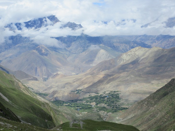
The view down into the valley that we were descending 5,000+ ft into from The Pass
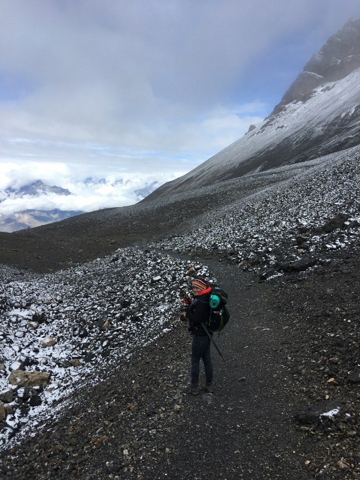
Hiking down!
We hugged and hugged and then suddenly were very cold and had to add on some warm layers now that we weren’t exerting ourselves. My new Nepali wool hat and gloves were perfectly nice and warm at the height of our elevation. We took a few pictures and waited for our new friends, Ryan and Meg, to join us so we could take a few more pictures and celebrate together. Giovanni and Jon had already crossed over the Pass just before the rest of us.
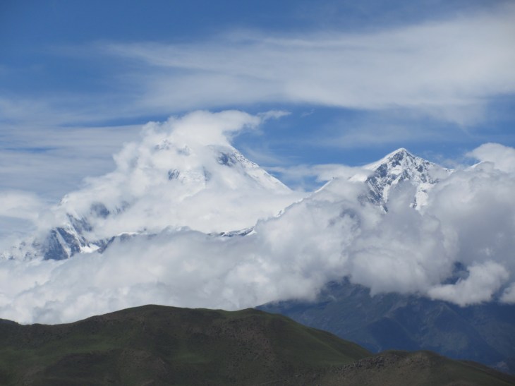
We were so fortunate to be hiking on a clear day and were rewarded with STUNNING views of Dhaulagiri over Muktinath – 26,795 ft tall. Yes, you read that correctly – Unbelievable!
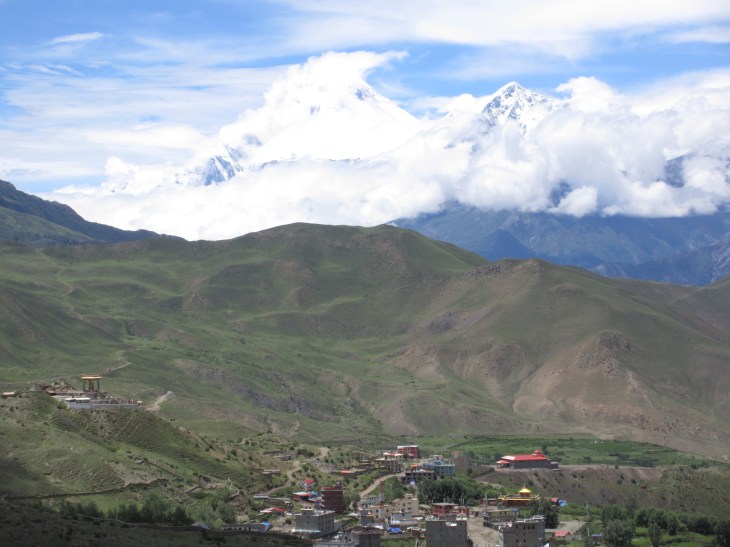
Dhaulagiri towering over Muktinath
We have spoken with lots of hikers who crossed The Pass both a few days before and after us and they all said that they didn’t have any good views. One guy in Muktinath who went the opposite direction as us waited FIVE days there to have a clear view and just so happened to go the same day that we crossed it. We didn’t plan it that way, but were SO fortunate!

On the 5700ft decent the sky cleared of the snowy mist and several peaks of the Himalayas came into clear view. After about 3 more hours of careful climbing down we reached the village of Muktinath and celebrated with a few good cold large Gorkha beers with everyone who crossed the pass that morning.
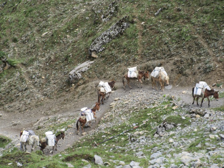
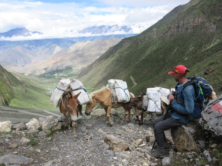
Hiking down from The Pass we crossed paths with the supplies coming up for the lodges we had just slept at
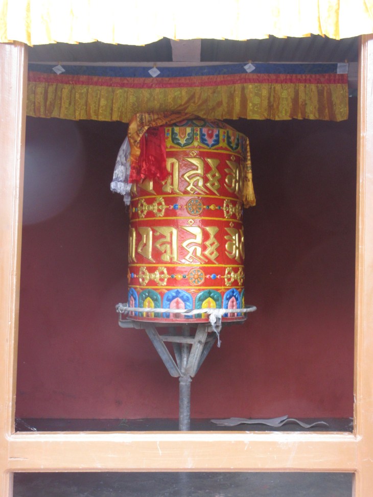
Prayer wheels greets us in Muktinath
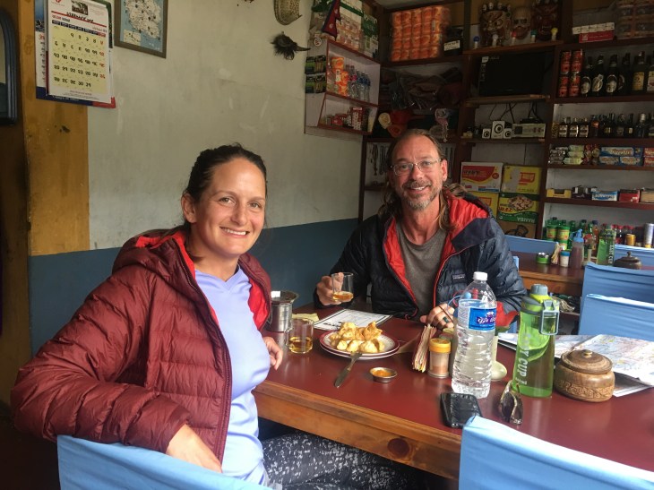
We finally found the best momos in Nepal in Muktinath. We went 2 days in a row
Our little trail family group has been amazing and supporting of each other from when we all met on the way to Tilicho Tal, traversing the high valleys and our ultimate ascent up and over Thorung La Pass together. The Annapurna Circuit has many options now that we are in Muktinath. It is likely that we go in different directions from here, but we will always share our memories of the last 5-6 days together. Many, many thanks to all of you from the bottom of my heart.
A couples more gratuitous photos from the summit 🙂
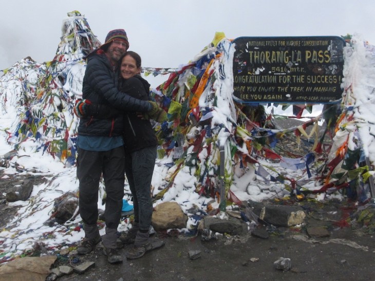

Congratulations!
LikeLike